Echo 136
About the race
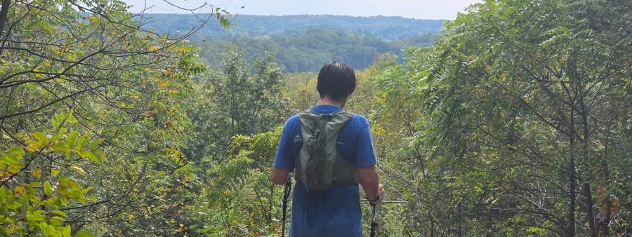
The Southern Unit of the Kettle Moraine State Forest is where you will start your 136-mile journey headed North.
All of the miles you travel on are those of the Ice Age State Trail. The course includes gentle wide groomed trails, single tracks, bike paths and road connectors.
Aid station food and drink
Aid stations will be a mix of tents, buildings, homes and pavilions. Stations will be stocked with water, soda, ice and an electrolyte drink.
Food will include candies, crunchies, salty items, warm hearty food and cold grabs, depending on the times the stations are open. A menu will be posted for the main entrée.
Dietary needs
- Vegan, vegetarian, carnivore, gluten free and “I’ll eat whatever” diets are all considered.
- Celiac runners: contact the organizers and your food can be stored at the aid stations you choose.
- Gluten cross-contamination cannot be guaranteed.
Crew and pacers
Pacers are invited to join you at Aid Station 4, Centennial Park. After that, pacers may be dropped off or picked up at any aid station. You may have more than one, but fewer than three, pacers at a time.
- Crew is not allowed at AS 7.
- At AS 7, pacers can only be picked up and dropped off, within a two-minute window.
- Crew is allowed at every other aid station.
Crews may use businesses along the way or public restrooms as needed. Please remain well mannered.
Event name meaning
“Echo” asks for the demons to HOLLA BACK, to show us what you’ve got and then destroy your limits. Lessons bounce off the rocks, roots and trees to come back to you as a response to relentlessly persist forward.
You will be challenged, and it will almost always get worse, but you will come out of the valley to a peak again. Your desire to complete the course is a statement you make on your own.
The organizers will be there with you every moment.
Awards
The top 3 overall women and top 3 overall men receive a podium award.
All other finishers receive a useful, theme-specific item, to be determined. There are no finisher medals or buckles.
Race day rules
- No alcohol is provided. Crews may bring their own, but not at any aid station.
- No race day sign-up is available.
- No cowbells or noise makers are allowed.
- Cupless: no single-serve disposable cups are provided. Vessels will be refilled as needed.
- Crews must follow all rules, laws and posted signs. Any crew problem will result in disqualification.
- Runners must be 18 years of age to register.
- Pacers must be 16 years or older, unless accompanied by an adult.
Encourage runners by clapping, cheering and vocal support.
GPX files and required app
GPX files will not be provided, because the route file does not accurately show updates to the Ice Age Trail.
The FarOut app is required gear. You will not start without this offline map available to show.
The course
The race starts at the Southern Unit of the Kettle Moraine State Forest and heads North. All miles are on the Ice Age State Trail. The course includes gentle wide groomed trails, single tracks, bike paths and road connectors. Runners connect sections to aid stations over the 55 hours given.
Aid stations and distances
There will be 9 fully stocked aid stations on the course. Mile markers are from the FarOut app of the Ice Age Trail map. Mileage may change because the trail is in constant work, and any changes will be updated.
A more thorough description will be in the Runners Manual, posted on the website at Tydish.org.
- Start: Rice Lake boat launch (868.9)
- AS 1: Young Road trail intersection (879.9)
- AS 2: Scuppernong trailhead (898.1)
- AS 3: Deeds place (913)
- AS 4: Centennial Park (924.6). Pacers can start here.
- AS 5: Emerald Dr. trailhead (936.9). Pacer pickup/exchange.
- AS 6: Nature Trail lot at Pike Lake (948.1). Pacer pickup/exchange.
- AS 7: Paradise Dr. trailhead (959.5). Pacer pickup/exchange.
- AS 8: Sunburst ski hill lot/Ice Age trailhead (970.4). Pacer pickup/exchange.
- AS 9: Butler Lake “stairs to nowhere” trailhead (989.7). Pacer pickup/exchange.
- Finish: CTH P (1004.6)
Total elevation gain is 11,148 ft. and loss is 10,961 ft., accumulated from sections created in Gaia GPS when making the GPX file. Your device or source will measure differently. These figures are the closest approximation the organizers can provide.
Location
State Park Dr., Whitewater, WI, USA Open in Google Maps
City insight: Whitewater
Whitewater is a city in Walworth and Jefferson counties in southern Wisconsin, United States, with a population of 14,889 at the 2020 census. It is located near the southern portion of the Kettle Moraine State Forest and is home to the University of Wisconsin–Whitewater. Winters are cold and snowy and summers are warm and humid, so spring and autumn are the best seasons to race.
Know from the athletes
Similar races

Quiet Silence
Frozen Gnome

Childish Nonsense
Sugar Badger 50/50 and Half
Six Days in the Dome
Badger Trail Races by Ten Junk Miles Racing
SkunkApe 806/524/314 Trail Race
NK50k
Rumble on the Ridge
Social profiles