The Timp Trail Marathon and Half
About the race
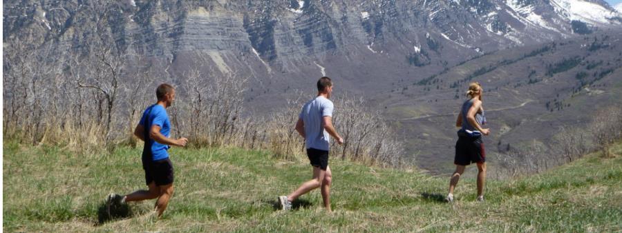
The Timp Trail Marathon and Half is a mountain trail race starting and finishing at Timpanogos Park in Orem.
This is a very challenging marathon course. The course is made up of 99.9% mountain trail and fire break roads.
Although the distance is that of a traditional marathon, it is anything but traditional. Treat this race course like an ultra-distance race.
Amenities and support on the marathon
There will not be porta-johns, mile markers, spectators or volunteers showing you which way to go.
Race shirts
As the Timp website states, late registrants are not guaranteed a race shirt.
The course
Marathon
Half Marathon
The race is run on mountain trail and fire break roads, starting and finishing at Timpanogos Park. Both distances are marked with pink and blue flagging, and pink shows the way. Pink and blue combined signals a turn on the side of the trail that is flagged. The course description is the same for both distances.
Marathon aid stations
- #1 Starting Line
- #2 Cliff Edge - 5.34 (2.45 miles to next aid)
- #3 Dry Canyon Trailhead - 7.7 (2.46 miles to next aid)
- #4 Battle Creek Trailhead - 10.25 (1.14 miles to next aid)
- #5 Grove Creek Trailhead - 11.39 (6.76 miles to next aid)
- Drop bag available. The drop area for clothing and gear will be returned to the starting area after the last runner clears the aid station.
- #6 Battle Creek Trailhead - 18.15 (2.46 miles to next aid)
- #7 Dry Canyon Trailhead - 20.61 (4.68 miles to next aid)
- #8 Cliff Edge - 25.29 (1.34 miles to the Finish Line)
- #9 Finish - 26.63
Cutoff times
- Grove Creek: you must be out of the Grove Creek aid station (mile 11.39) by 10am.
- Battle Creek: you must be out of the Battle Creek aid station (mile 18.15) by 12:20pm.
- Dry Canyon: you must be out of the Dry Canyon aid station (mile 20.61) by 1pm.
Course marking and race briefing
Both distances will be marked with pink and blue flagging. Pink shows the way, and pink and blue combined signals a turn on the side of the trail that is flagged. We will review this along with updated course conditions at the race start, 15 minutes before the start.
Course knowledge
We are running the same course as last year, still starting and finishing at Timpanogos Park. The course description is the same for both distances. Know the course, run with someone who knows the course, or be able to follow the course description and/or GPX course maps.
Course terrain and conditions
The Marathon course has 5,883 feet of elevation gain. The course is made up of 99.9% mountain trail and fire break roads. The only asphalt your trail shoes will touch is a few crossings as you traverse northbound at the lower elevations.
There are sections of ascent and descent that will be technical but extremely scenic. As in the past, you may experience snow, rain, mud and potential stream crossings, but without a doubt, rocks.
If you run a 3:30 marathon, expect to finish this race between 5 and 6 hours.
Location
Timpanogos Park, Orem, UT, USA Open in Google Maps
City insight: Orem
Orem is a city in Utah County, Utah, in a high desert at an elevation of about 1,450 metres, near the eastern shore of Utah Lake and below the Wasatch Mountain range with Mount Timpanogos. It is next to Provo, about 72 km south of Salt Lake City, and is home to Utah Valley University.
Know from the athletes
Similar races
Dimple Dell Blitz Backyard
Bonneville Backyard Ultra
Butterfield Blitz Backyard
Rose Canyon Ultra
Snow Peaks 50 Mile Trail Run

Salt and Sulfur 420
Trippin' Through The Timber
Tooele Turkey Trail Trot 'Til You Drop
Connor's Claims Ultra

Social profiles