Connor's Claims Ultra
About the race
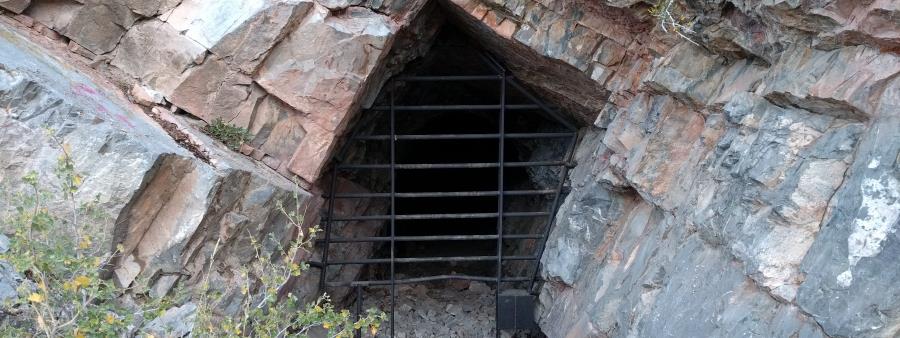
Join us in our 7th year of conquering the hills and mountains where General Patrick Connor and his soldiers staked numerous mining claims in the early 1860s.
As you cruise along steep mining roads, ascend towering peaks, and navigate gnarly ATV trails, you'll be treated to majestic views of the surrounding Oquirrh, Stansbury, and Onaqui Mountains, as well as beautiful Rush Valley.
We create our events, especially our courses, to give you a beautiful, challenging, fun experience, racing in the foothills and mountains of Tooele County's Oquirrh Mountains.
Race philosophy and awards
Our prices are low. We don't give out gimmicky race entry bags full of clutter you'll never use, we don't hand out finisher's awards that end up in a drawer somewhere, and we don't play thumping music, announce finishers over a PA, or display flashy finish line arches.
The course is where it's at. Each year we change up the course routes, with an eye for scenery and the challenge: what the runner will see as they fly down technical double-track or crest a tough summit climb. Each distance will treat you to challenging trail conditions and beautiful views of the surrounding Oquirrh and Stansbury Mountain Ranges and the Rush and Tooele Valleys.
Our aid stations will help you get to the finish line. The vibe will be very low-key, but you'll face stiff competition, whichever distance you choose.
The top three men and women in each distance will receive a modest award.
We look forward to having you, and are excited to show off some of the great trails the Oquirrh's have to offer.
The course
50 Miles
50K
Half Marathon
The races take place in the foothills and mountains of Tooele County's Oquirrh Mountains. The courses use mining roads, ATV trails and technical double-track, with steep climbs and summit routes. Routes change from year to year. The 50-Mile and 50K courses both climb to Porphyry Hill and Bald Mountain, and the Half Marathon climbs to Bald Mountain West.
50-Mile course route
The 50-Mile Course will take you up the old Gisbourne Toll Road, through the Jacob City Ruins, down Dry Canyon, along the rolling Bald Mountain foothills, up Soldier Canyon and its South Fork, down Chandler Fork, around the Lion Hill Loop Trail and to the summit of Porphyry Hill (8,716') - twice! - , back up Chandler Fork, up to Bald Mountain East (10,006'), down to Commodore Pass, up Bald Mountain West (9,626'), & back down the old Gibson Toll Road!
You'll be faced with 5 substantial climbs, ranging between 2,000 & 3,300 ft each!
Aid stations
- Aid Station #1 Jacob City (mile 4.75)
- Aid Station #2 Start/Finish Area (mile 12.5)
- Aid Station #3 Soldier Canyon (mile 18.6)
- Aid Station #4 Ophir Canyon (mile 23)
- Aid Station #5/6/7 Lion Hill Loop Trailhead (miles 24, 32, & 40)
- Aid Station #8 Commodore Pass (mile 45.5)
Surface and cutoffs
- Total Mileage: ~52 miles
- Total Vert: ~14,000 ft.
- Mining Road/ATV Trail: 98%
- Off-Trail: 2%
- Hard Cutoffs: Mile 40 - 14 hours (7:00 pm); Mile 52 - 19 hours (12:00 am)
50K course route
The 50k Course will take you up Soldier Canyon and its South Fork, down Chandler Fork, around the Lion Hill Loop Trail and to the summit of Porphyry Hill (8,716'), back up Chandler Fork, up to Bald Mountain East (10,006'), down to Commodore Pass, up Bald Mountain West (9,626'), & back down the old Gisbourne Toll Road!
You'll be faced with 3 substantial climbs, ranging between 2,000 & 3,300 ft each!
Aid stations
- Aid Station #1 Soldier Canyon (mile 6.2)
- Aid Station #2/4 Ophir Canyon (mile 10.5 & 20)
- Aid Station #3 Lion Hill Loop Trailhead (mile 11.7)
- Aid Station #5 Commodore Pass (mile 24.3)
Surface and cutoffs
- Total Mileage: 31.1 miles
- Total Vert: ~9,500 ft.
- Mining Road/ATV Trail: 97%
- Off-Trail: 3%
- Hard Cutoff: Mile 20 - 8 hours (2:00 pm); Mile 31.1 - 12 hours (6:00 pm)
Half Marathon course route
The Half-Marathon Course will take you up a gnarly OHV trail and up the old Gisbourne Toll Rd, to the lofty summit of Bald Mountain West (9,626'), and back down the Gisbourne Toll Rd!
Aid stations and cutoffs
- Aid Station #1/2 Jacob City (miles 4.6 & 9)
- Total Mileage: 13.8 miles
- Total Vert: ~3,900 ft.
- Mining Road/ATV Trail: 100%
- Overall Cutoff: Mile 13.8 - 4.5 hours (10:30 am)
Race weekend schedule
Location
Jacob City Trailhead, Stockton, UT, USA Open in Google Maps
City insight: Stockton
Stockton is a city and county seat of San Joaquin County in California's Central Valley, on the San Joaquin River, with 320,804 residents at the 2020 census. It was founded in 1849 during the California Gold Rush. Summers are hot and dry and winters are mild, so spring and autumn are the best seasons to race.
Know from the athletes
Similar races
Tooele Turkey Trail Trot 'Til You Drop
Dimple Dell Blitz Backyard
Butterfield Blitz Backyard
Rose Canyon Ultra
Salt and Sulfur 420
Pony Express Trail Run
Bonneville Backyard Ultra
The Timp Trail Marathon and Half
Snow Peaks 50 Mile Trail Run

Social profiles